Hiking Routes in Switzerland: Your Alpine Trail Guide
Switzerland’s hiking routes offer unparalleled access to pristine Alpine landscapes, from flower-filled meadows to glacial valleys and iconic mountain peaks. These well-maintained trails provide adventures for every fitness level, connecting charming villages with panoramic vistas and rich cultural heritage. This guide covers essential trail information, seasonal planning, and practical tips for a seamless journey on Swiss hiking paths.
Essential Swiss Hiking Information
Switzerland’s trail network is meticulously managed, marked by a uniform yellow sign system indicating destinations and walking times. The Swiss Alpine Club (SAC) classifies routes by difficulty, ranging from T1 (easy) to T6 (alpine). A valid travel insurance policy covering mountain rescue is strongly recommended for all hikers exploring these terrains.
The country’s public transport system, including trains, buses, and cable cars, is perfectly integrated with trailheads. This allows for point-to-point hiking without needing a car. Purchasing a Swiss Travel Pass or a Half-Fare Card can yield significant savings on these transport costs.
The Swiss Hiking Trail Classification System
Understanding the local trail markers is key to a safe and enjoyable hike.
- Yellow Signposts: These show directions, destinations, and estimated walking times in hours and minutes, not distance, which is more accurate for mountain terrain.
- White-Red-White Trail Markings: Painted on rocks, these indicate mountain trails (T2-T3) that may have steep, exposed sections and require sturdy footwear.
- White-Blue-White Markings: These signify Alpine routes (T4-T5) which are often unsecured, require scrambling, and demand good orientation skills and proper equipment.
- Budget Hiker ($70-100/day): Stay in hostel dorms or campgrounds, cook your own meals, and hike mostly accessible valley trails or use a Half-Fare Card for discounted transport. Focus on one region to minimize travel costs.
- Mid-Range Hiker ($150-250/day): This covers private rooms in guesthouses or mountain huts with half-board, a Swiss Travel Pass for flexible transport, and occasional cable car ascents. You can enjoy point-to-point hikes and dine out for lunches.
- Premium Hiker ($300+/day): Stay in classic mountain hotels with spa facilities, book guided private tours for high Alpine routes, and use taxis or private transfers for maximum trailhead flexibility. Dine at renowned mountain restaurants.
- Switzerland Tourism Hiking Portal
- Swiss Alpine Club (SAC)
- AllTrails Switzerland Hiking Maps
Key Regions and Their Character
The Bernese Oberland is famous for its dramatic trio of peaks: Eiger, Mönch, and Jungfrau. Trails here, like the route from Grindelwald to Männlichen, offer front-row views of these giants. The region features efficient cable cars that lift hikers above 2,000 meters quickly.
Central Switzerland, around Lake Lucerne and Mount Pilatus, provides slightly gentler terrain with lush forests and lake views. The Swiss Path around Lake Uri is a national heritage trail with historical plaques. It’s ideal for those seeking cultural context alongside natural beauty.
Historical and Cultural Trail Context
Many Swiss Alpine paths follow ancient trade and pilgrimage routes used for centuries. The Via Alpina, for example, is a long-distance network crossing eight countries, with Swiss sections traversing historic passes. Mountain inns, or “Berghotels,” have been welcoming travelers since the 19th century.
These routes often pass through working Alpine farms. Hikers may encounter herds of cows, goats, or sheep being moved to seasonal pastures. Respecting these agricultural activities by closing gates and keeping dogs leashed is part of local trail etiquette.
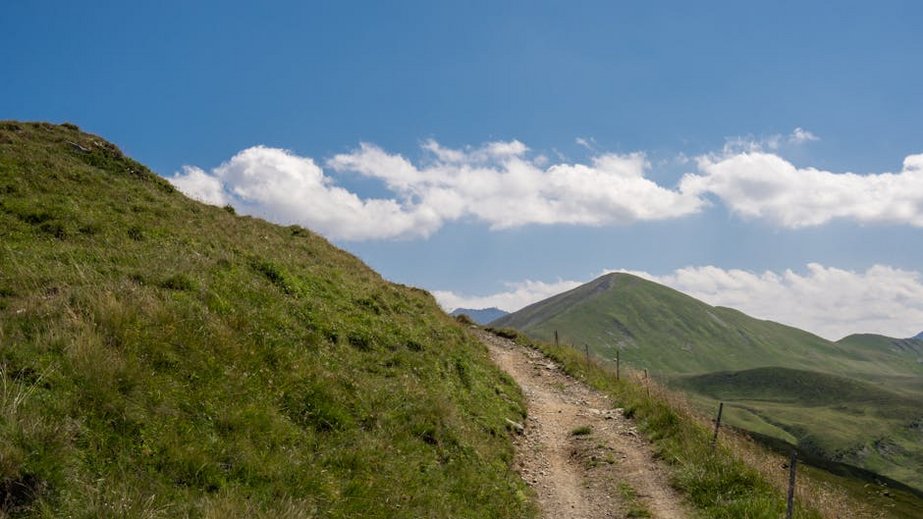
Alt: “swiss-alps-hiking-trail-panoramic-mountain-view”
Hiking Routes in Switzerland – Planning Your Trip
Successful planning for Swiss Alpine trails hinges on accurate seasonal timing and realistic fitness assessments. The core hiking season runs from late June to September, but snow can linger on high passes into July. Always check local conditions and cable car operations before committing to a specific high-altitude route.
Budget for transport and accommodation as your two largest costs. While trail access is free, reaching remote trailheads often requires a train or cable car ticket. Mountain huts provide the most authentic experience but require advance booking, especially in August.
Best Time to Hike in Switzerland
The peak season is July and August, offering the most reliable weather with daytime temperatures between 65-75°F (18-24°C) at valley level. All trails and mountain huts are open, but this also means higher prices and more crowded paths, particularly on classic routes like the Five Lakes Walk at Pizol.
Shoulder seasons like June and September present excellent alternatives. June features blooming wildflowers at mid-altitudes, while September offers cooler air, fewer crowds, and potential early autumn colors. Be prepared for more variable weather and check if high-Alpine passes are still navigable.
Budget Planning and Costs
Your daily budget varies drastically based on accommodation style and transport passes.
Essential Preparation Checklist
Packing requires a focus on layering and preparedness for rapid weather changes. Essential gear includes waterproof hiking boots with ankle support, a Gore-Tex shell jacket, moisture-wicking base layers, warm mid-layers like a fleece, and sun protection (hat, glasses, SPF 50+). Always carry a detailed physical map and compass as a backup to digital devices.
Documentation includes a valid passport, travel insurance with explicit mountain rescue coverage, and any pre-purchased transport passes. Book popular mountain huts and hotels at least 3-4 months in advance for summer trips. Download offline maps via the SwitzerlandMobility app and check the official SAC avalanche bulletin for high-Alpine conditions.
Top Trail Routes and Experiences
The diversity of Swiss trails means you can choose between gentle lakeside strolls and challenging high-mountain traverses. Iconic routes often connect via cable car or train, allowing you to customize daily distance and elevation gain. Many trails pass by working farms where you can purchase local cheese directly from the producer.
For a sense of accomplishment, multi-day hikes like the Haute Route or stages of the Via Alpina are unbeatable. These require careful planning but offer immersion in remote landscapes. Simpler day hikes from villages like Mürren or Zermatt provide equally stunning vistas with less logistical complexity.
Must-See Classic Hikes
The Eiger Trail from Alpiglen to Eigergletscher is a thrilling 2-hour hike directly under the North Face of the Eiger. It involves some steep, rocky sections but rewards with unparalleled views. Access is via train to Alpiglen or from Grindelwald, with a one-way ticket costing around $30.
For iconic Matterhorn views, the 5 Lakes Walk (5-Seenweg) starting from Blauherd cable car station above Zermatt is essential. This moderate 2.5-hour loop passes Stellisee, where you can capture the mountain’s perfect reflection on a calm morning. The Zermatt-Blauherd cable car costs approximately $50 round-trip.
The panoramic trail from Männlichen to Kleine Scheidegg in the Bernese Oberland is a family-friendly classic. This mostly flat 1.5-hour path offers continuous views of the Jungfrau massif. You can take a cable car up from Wengen or Grindelwald, then hike down or take the train back.
Hidden Gems and Local Favorites
In the Engadin Valley near St. Moritz, the hike to Lej da Staz (Staz Lake) is a local favorite. The easy trail winds through fragrant stone pine forests to a tranquil, emerald-green lake, far from the glamorous crowds. Reach it by a 30-minute walk from the Staz train stop.
The Val Calnègia in the Italian-speaking Valle di Campo is a step back in time. A steep path descends to a cluster of ancient, stone-slab-roofed houses that are only inhabited in summer. The hike is challenging but offers a unique glimpse into traditional Ticino life rarely seen by tourists.
Multi-Day Trekking Adventures
The Haute Route from Chamonix, France, to Zermatt, Switzerland, is a world-class 12-14 day trek. The Swiss section traverses high passes like the Col de Prafleuri, requiring good fitness and resilience to altitude. Most hikers stay in a mix of mountain huts and village hotels, needing to book huts months ahead.
A more accessible multi-day option is the 4-day hike from Meiringen to Grindelwald via the Grosse Scheidegg pass. This route stays at lower altitudes, uses charming village inns for accommodation, and still delivers phenomenal views of the Wetterhorn and Eiger. Luggage transfer services between hotels are available.
Practical Travel and Logistics
Switzerland’s efficiency extends to its travel infrastructure, making navigation between trailheads straightforward. Major international airports are in Zurich (ZRH) and Geneva (GVA), with excellent train connections to mountain regions. For hiking-focused trips, consider flying into Milan Malpensa (MXP) for quicker access to the trails of the Ticino region.
Accommodation ranges from budget-friendly hostels and campgrounds to luxurious mountain resorts. The most authentic experience comes from staying in a managed mountain hut (SAC Hut), which provides dormitory-style lodging and hearty meals. Booking these is essential during peak season.
| Accommodation Type | Features & Experience | Avg. Price Per Night (USD) |
|---|---|---|
| SAC Mountain Hut | Dormitory bunk, shared bathroom, half-board (dinner & breakfast), basic but sociable atmosphere. | $60-90 per person |
| Family Guesthouse (Gasthof) | Private room with ensuite, Swiss breakfast, often family-run with a restaurant, central village location. | $120-200 per room |
| Mountain Hotel (Berghotel) | Private room with balcony, half-board, spa/sauna, often located directly on a trail with panoramic views. | $250-400 per room |
| Alpine Resort (e.g., Zermatt) | Luxury amenities, multiple restaurants, concierge, guided tour booking, prime location with cable car access. | $400+ per room |
