Italy Cinque Terre Hiking Trail Map
Navigating Italy’s Cinque Terre with a detailed hiking trail map transforms your visit from a scenic day trip into a structured, immersive adventure across five historic fishing villages. The trail network, managed by the Parco Nazionale delle Cinque Terre, connects Monterosso, Vernazza, Corniglia, Manarola, and Riomaggiore, offering coastal panoramas, vineyard traverses, and cliffside pathways. This guide details the official map’s routes, provides essential planning tips for the variable terrain, and explains how to use the trail system to maximize your experience while respecting preservation efforts.
Essential Cinque Terre Trail Information
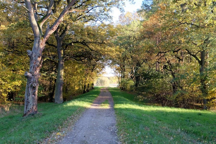
The Cinque Terre trail system is a network of coastal and high-altitude paths that have linked the villages for centuries. Managed by the Parco Nazionale, the primary coastal route (Sentiero Azzurro, or Blue Trail) is the most famous, though sections frequently close for maintenance or landslide risk. A Cinque Terre Hiking Trail Map is indispensable, as it differentiates between open/closed trails, shows elevation gain, and marks critical facilities like water stations and train access points, which are your bail-out options if trails become too challenging.
Hiking here is less about wilderness and more about cultural landscape traversal through terraced vineyards and medieval villages. The trails are not a loop but a linear system, with the regional train or boat services providing essential return logistics. Understanding this interconnectivity between footpath, rail, and sea is the key to a seamless day, allowing you to hike one section and easily return to your starting point.
Understanding the Trail Color and Number System
The official map uses a coded system to classify trails by difficulty and type.
- Sentiero Azzurro (Blue Trail, SVA): This is the classic coastal route, numbered 1 through 9. The most popular segments connect the villages directly, with the trail from Vernazza to Corniglia offering some of the most iconic photography spots along the entire Ligurian coast.
- Sentiero Rosso (Red Trail, AV5T): This is the high route, running along the ridge above the villages. Marked as Trail #1, it’s longer (about 40km total) and more strenuous but offers breathtaking panoramic views and far fewer crowds than the coastal path below.
- Secondary Trails (Numbers 500+): These paths, like the steep #500 from Corniglia to its train station or #586 through the vineyards, serve as connectors between the main trails and villages, often involving significant stair climbs.
- Budget Hiker (€50-€75/day): This covers a dorm bed in La Spezia (€25-€35), the Cinque Terre Trekking Card (€7.50), train tickets from La Spezia (€5 each way), and self-catered meals from grocery stores or focaccerias. Staying outside the national park in La Spezia or Levanto significantly cuts accommodation costs while keeping you on the train line.
- Mid-Range Traveler (€100-€180/day): This budget allows for a private room in a village B&B (€80-€120), the Trekking Card, unlimited train travel with the Cinque Terre Treno Card (€18.50/day), and meals at casual trattorias. You gain the convenience of staying within the park and enjoying the villages in the quiet early mornings and evenings.
- Luxury Experience (€250+/day): This tier includes stays at boutique hotels like Hotel Porto Roca in Monterosso (€200+), private guided hiking tours (€50-€100 per person), fine dining with seafood and local wines, and boat tours for unique coastal perspectives. It prioritizes comfort, exclusive access, and curated experiences.
- Parco Nazionale delle Cinque Terre Official Website
- Trenitalia (Italian National Railways)
Key Details on Trail Passes and Regulations
To hike the main coastal trails between Monterosso and Riomaggiore, you must purchase a Cinque Terre Trekking Card. This funds the conservation of the historic dry-stone walls and paths. The card costs approximately €7.50 for one day and includes access to the village shuttle buses and Wi-Fi. You can buy it at trail entrances, train stations, or online. Your hiking trail map will show the checkpoint locations where rangers may ask to see your pass.
Strict regulations protect the fragile ecosystem. Hiking outside designated hours (typically dawn to dusk) is prohibited. Drones require special authorization, and swimming from the trails is forbidden due to dangerous currents. Staying on marked paths is both a safety rule and an environmental necessity, as the steep slopes are prone to erosion. The map clearly marks protected zones and restricted areas.
Navigating Trail Closures and Conditions
Trail closures are common, especially after heavy rain. The most famous segment, the Via dell’Amore (Path of Love) between Riomaggiore and Manarola, has been closed for years due to a major rockfall. Always check the official Parco Nazionale website for the latest status before your visit. A current trail map will indicate alternative high routes or train connections to bypass closed sections, ensuring your itinerary remains flexible and safe.
Alt: “cinque-terre-hiking-trail-map-coastal-path-vernazza”
Italy Cinque Terre Hiking Trail Map – Planning Your Trip
A strategic approach to your Italy Cinque Terre hiking trail map adventure hinges on timing, physical preparation, and logistical savvy. The ideal window avoids both the suffocating summer crowds and the wet, slippery conditions of winter. Your map is not just for navigation; study the elevation lines to understand the true physical demand of connecting villages like Corniglia and Vernazza, which involve hundreds of stone steps and steep climbs that surprise many unprepared travelers. Factor in the Mediterranean sun, which offers little shade on the coastal trails.
Logistically, your map should be paired with the train timetable. The regional train is the spine of the Cinque Terre, running frequently between La Spezia and Levanto, stopping at all five villages. Plan point-to-point hikes, using the train to return to your origin or accommodation. For instance, you could take the train from your base in Monterosso to Riomaggiore, then hike back northward, catching the train from any village if you tire. This method maximizes flexibility.
Best Time to Hike the Cinque Terre Trails
The prime seasons for hiking are April-May and September-October. During these months, daytime temperatures range from a comfortable 65-75°F (18-24°C), wildflowers bloom in spring, and vineyards turn gold in autumn. Summer (June-August) sees intense heat, often exceeding 86°F (30°C), dense crowds on the narrow paths, and a high chance of trail sections being closed due to fire risk. Winter can be rainy and cool, around 50°F (10°C), making stone steps treacherously slippery, though it offers complete solitude.
Budget Planning and Costs
Costs vary based on your travel style, but daily hiking expenses are manageable.
Essential Preparation Checklist
Your gear can make or break the experience. Footwear is paramount: wear sturdy, broken-in hiking shoes or trail runners with excellent grip for uneven stone and dirt paths. Never attempt the trails in sandals or flip-flops. Pack a daybag with at least 1.5 liters of water per person, as refill stations are limited, high-energy snacks, sun protection (hat, sunscreen, sunglasses), and a light waterproof layer. The microclimate can change quickly.
Essential documentation includes your Trekking Card (purchasable on arrival), travel insurance that covers hiking, and a printed or downloaded offline version of your trail map. Book accommodation months in advance for peak season, especially within the villages. Physically, prepare with stair-climbing or hill-walking in the weeks before your trip to condition your knees for the relentless ascents and descents.
Top Trails and Scenic Routes
While the coastal Sentiero Azzurro gets the most attention, the trail network offers diverse experiences. The hike from Monterosso al Mare to Vernazza is often the first leg for north-to-south travelers, a 90-minute journey featuring a challenging climb out of Monterosso rewarded with the first breathtaking reveal of Vernazza’s harbor. The path from Vernazza to Corniglia is arguably the most picturesque, winding through lemon groves and offering unimpeded sea views, though it involves a steep descent into Corniglia followed by the infamous 382-step “Lardarina” staircase to the village center.
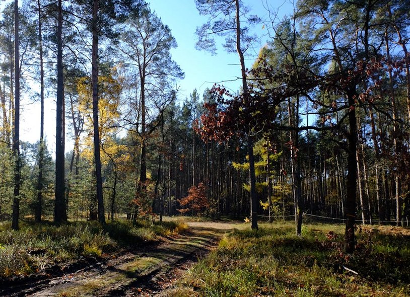
For those seeking solitude, the high-altitude trails like the one from Portovenere to Riomaggiore (a segment of the Red Trail) provide a full-day challenge with eagle-eye vistas of the entire archipelago. These routes pass through ancient hamlets and chestnut forests, revealing the agricultural backbone of the region far from the tourist bustle. Using your map to combine a morning high route with an afternoon coastal stroll creates a perfectly balanced day.
Must-See Highlights Along the Paths
Beyond village views, specific landmarks dot the trails. Between Manarola and Corniglia on Trail #6, you’ll find the “Telegrafo” section, a particularly narrow cliffside path with some of the best photography angles. In the vineyards above Vernazza, look for the “Santuario della Madonna di Reggio,” a peaceful chapel that’s a popular rest stop. The Guvano beach access, a former nudist beach reachable only by an unmarked path, is a legendary spot for adventurers, though access is often officially closed and requires careful local inquiry.
Each village has its trailhead charm. The start of the path in Riomaggiore winds past colorful boats in the marina. The Monterosso trailhead begins near the giant statue of Il Gigante. These starting points are well-marked on any good map and are usually a short walk from the respective train stations, making navigation straightforward once you’re in the village.
Hidden Gems and Local Favorites
Locals often prefer the inland trails connecting the sanctuaries above each village. The path from Monterosso to the Soviore sanctuary is a serene, wooded climb ending at one of the oldest Marian shrines in Liguria. Similarly, the staircase from Vernazza up to the Santuario di Nostra Signora di Reggio is less crowded and offers a shady alternative during hot afternoons. These routes are detailed on comprehensive maps and provide a spiritual and cultural dimension to the hiking experience.
For a unique vineyard experience, seek out the “Ciape” terraces near Volastra (a hamlet above Manarola). Some wineries, like Walter De Batté, offer tours by appointment that can be woven into a hiking day. This involves taking the shuttle bus from Manarola up to Volastra, visiting the vineyards, and then hiking down. It’s a fantastic way to understand the “heroic viticulture” that defines the landscape you’re walking through.
Sunset and Sunrise Hike Recommendations
For photographers, timing is everything. The best sunset views are from the trail looking west toward Manarola and Corniglia. A popular spot is on the trail just north of Manarola, where you can watch the sun sink behind the village’s pastel buildings. For sunrise, the eastern-facing trail between Riomaggiore and the now-closed Via dell’Amore offers a spectacular glow. Since official trails close at dusk, plan to be at a viewpoint just before closing time, and always have a headlamp for the walk back to the village on safe, paved roads.
Practical Travel Information and Logistics
Getting to the Cinque Terre trailheads is straightforward via Italy’s rail network. The closest major airports are Genoa (GOA) and Pisa (PSA), both about 90 minutes away by train. From there, regional trains run to La Spezia Centrale, the main gateway. You can store luggage at the La Spezia station if you’re day-tripping. Once in the park, the local Cinque Terre Express train runs every 15-20 minutes, connecting all villages and making point-to-point hiking perfectly feasible. Ferries also operate between villages (except Corniglia) from March to October, providing a scenic alternative.
Accommodation inside the national park is limited and books up extremely early. Options range from hostels and guesthouses to upscale hotels. Many visitors opt to stay in La Spezia, which offers more availability, lower prices, and easy 10-minute train access to the first village, Riomaggiore. Levanto, to the north, is another excellent base with its own beach and direct trail connection to Monterosso.
| Accommodation Type | Location & Features | Price Range (USD/Night) |
|---|---|---|
| Hostel / Guesthouse | La Spezia or Levanto; shared facilities, kitchen access, near train station. | $35 – $70 |
| Bed & Breakfast | Within a Cinque Terre village (e.g., Manarola); private room, breakfast included, limited availability. | $100 – $180 |
| Mid-Range Hotel | Vernazza or Monterosso; sea views, en-suite bathroom, often with a terrace. | $180 – $300 |
| Boutique Luxury Hotel | Clifftop locations (e.g., Porto Roca in Monterosso); panoramic pool, fine dining, spa services. | $300 – $500+ |
